 |
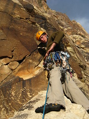
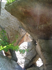
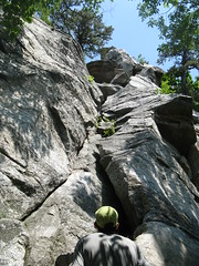
| "Jello" on the start of P2 |
Tuesday, May 11, 2010
The End Game: Epinephrine
Guidebook: Red Rocks Vegas - The Gobbler (5.10a), Dream of Wild Turkeys (5.10a), Frogland (5.8), Epinephrine (5.9 IV)
Eldorado Canyon
Black Velvet Canyon
Black Velvet Canyon
Monday, May 10, 2010
Guidebook: Shelf Road - Cactus Cliffs: Crynoid Corner (5.7), Banana Split (5.10a), Slicer (10b), Black Man's Burden (5.10b), The Killer Toupee (5.10b), Gabby (5.10c), Glass Babies (5.10c), The Alignment (5.10c), 3/4 Ton (5.10c), Axis of Evil (5.10c)
Shelf Road
Cactus Cliffs
Approach: As of late April 2010, the road to the parking area at the base of Catcus Cliffs is closed to public traffic. Climbers must park at The Bank day use area.
From The Bank parking area, walk down the road that is to the right when entering the lot. Take the first trail on the right and head down to the wash staying to the left where the trail T's. Then cross the wash and head back up hill, staying right where the sign points toward the Cactus Cliff area. Where the path meets the closed road, head left uphill a couple of hundred yards.
From the BLM sign, head along the path a few feet and head up a set of stairs on the left. Where the path continues to the right, find a path heading off to the left. This path comes out a bit right before the pock-marked right-facing corner that is Crynoid Corner (5.7).
All routes described below should be short enough for a 60m rope (we used a 70m but had plenty of extra rope), and they all have bolted anchors, too.
Guidebook: Gunks - Easy Keyhole (5.2), Bunny (5.6)
Easy Keyhole (5.2) - Two Pitches - Trad - Tree Anchors
Approach: One of the first climbs in the Trapps, walk down the carriage road until you get to the first obvious face with climbing on it (obviously on the left-hand side). Walk up the first path (has stone steps) after this face (around the corner from the arrete) to a thin crack on the left and an off-width on the right. Both are within 10 feet of the carriage road. Not a good route for beginning trad leaders.
Pitch One (5.2) - 60 feet - Tree Anchor: Stem the block that forms the offwidth on the right and jam the crack on the left (crux). Climb straight up this section to the roof. Climb up to the roof and exit left, belaying at a tree.

Pitch Two (5.1) - 60 feet - Tree Anchor: Walk right of the tree to the "keyhole." Climb up on the left-hand side, then trend left to the large ledges above. Belay from any of the solid trees.
Descent: Walk off left along the easy path that fades right. You will end up about 50 feet uphill from the start of the climb.
Bunny (5.6) - One Pitch - Trad - Tree Anchor
Approach: Walk down the carriage road to the Uberfall area. About twenty feet left of where the obvious roof starts, find the crack in a shallow, right-facing corner that starts a couple of steps up from the road that.
Bunny (5.6) - 130 feet - Tree Anchor: Climb the corner straight up to the tree. Climbing the roof that is midway up the route directly results in a 5.6. Stepping left and going around it makes this easier (5.4). A great route for beginning trad leaders. Belay at the tree that has slings for rappel.
Descent: Rap off the slings on the tree with two 60m ropes. Or, walk off right. The walk-off to the right has an easier-than-it-looks down-climb that is about 150 feet to the right of the climb.
Approach: One of the first climbs in the Trapps, walk down the carriage road until you get to the first obvious face with climbing on it (obviously on the left-hand side). Walk up the first path (has stone steps) after this face (around the corner from the arrete) to a thin crack on the left and an off-width on the right. Both are within 10 feet of the carriage road. Not a good route for beginning trad leaders.
Pitch One (5.2) - 60 feet - Tree Anchor: Stem the block that forms the offwidth on the right and jam the crack on the left (crux). Climb straight up this section to the roof. Climb up to the roof and exit left, belaying at a tree.

Pitch Two (5.1) - 60 feet - Tree Anchor: Walk right of the tree to the "keyhole." Climb up on the left-hand side, then trend left to the large ledges above. Belay from any of the solid trees.
Descent: Walk off left along the easy path that fades right. You will end up about 50 feet uphill from the start of the climb.
Bunny (5.6) - One Pitch - Trad - Tree Anchor
Approach: Walk down the carriage road to the Uberfall area. About twenty feet left of where the obvious roof starts, find the crack in a shallow, right-facing corner that starts a couple of steps up from the road that.
Bunny (5.6) - 130 feet - Tree Anchor: Climb the corner straight up to the tree. Climbing the roof that is midway up the route directly results in a 5.6. Stepping left and going around it makes this easier (5.4). A great route for beginning trad leaders. Belay at the tree that has slings for rappel.
Descent: Rap off the slings on the tree with two 60m ropes. Or, walk off right. The walk-off to the right has an easier-than-it-looks down-climb that is about 150 feet to the right of the climb.
Saturday, May 08, 2010
Guidebook: Eldorado Canyon - Washington Irving (5.6), Chianti (5.8+), The Unsaid (5.9), Next to Nearly (5.9)
Eldorado Canyon, Eldorado Springs, CO
The West Ridge
Approach: From the main parking lot just inside the gate, walk across the bridge and head left, staying low to the creek when other trails head up. Continue along until you come to a sign that says the trail ends. Walk past the sign and up a slick but well-worn ramp on rock near the creek. Make a very careful step over the top and downclimb, finding a worn path up right of the tiny beach area on the other side of the ramp. Head up right and find another, real trail, which is the West Ridge Trail.
Follow this trail up several hundred feet until you see a bunch of dihedrals that start on a ledge about 25 feet above the trail. On the right side of this ledge there is a fairly large boulder resting against the bottom of a slab. There is a tree growing next to the boulder.
All routes in this post can be safely descended by either lowering or rapping with a single 70m rope. A 60m rope will work if you are confident down-climbing easy-but-exposed slab for probably ten feet or so.
Guidebook: Cathedral Ledge - North End: Child's Play (5.6), Kiddy Crack (5.8), Bird's Nest (5.9-), They Died Laughing (5.9)
Cathedral Ledge
The North End
Approach: Drive down the Cathedral Ledge road and park in one of the lots just before the gate that marks the start of the road that goes to the top. Walk across the street from the small parking lots to the path marked by the sign. The crag is about 2min up and the right-hand crack at the top of the path is Kiddie Crack (5.7).
Sunday, May 02, 2010
Guidebook: 'Gunks - Near Trapps: Grease Gun Groove (5.6), Te Dum (5.7), Alphonse (5.8), Main Line (5.8), Grand Central (5.9), Broken Sling (5.9+), Criss Cross (5.10a), Birdcage (5.10b) Spinal Exam (5.10c)
'Gunks
Near Trapps
Approach: Take the path just after the Route 44/55 road sign as one walks downhill away from the Near Trapps Bridge. Routes noted below are arranged according to grade (easiest to hardest) and each has it's own approach directions.
Near Trapps
Approach: Take the path just after the Route 44/55 road sign as one walks downhill away from the Near Trapps Bridge. Routes noted below are arranged according to grade (easiest to hardest) and each has it's own approach directions.
Subscribe to:
Comments (Atom)


